
Feb 2013 Oil and Gas Lease Sale near Moab: EA Released
November 19, 2012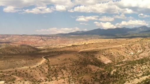
UPDATE 11/19/12: On November 16, the BLM released the map and the final Environmental Assessment for the February 2013 lease sale.
Satellite photo maps of SE Utah parcels to be auctioned:
Dolores/Colorado River confluence parcels
The parcels overlapping Monticello's Water Source Protection Zone, as well as further parcels in Lisbon Valley south of Moab, were deferred from auction. Parcel 042, which is just south of the Moab valley (though near proposed municipal and existing domestic water wells) is still going up for auction, as is Parcel 128 near the La Sal School well, and parcels on private land north of Monticello.
The period allowed for those who filed comments on the EA to file protests with the Interior Board of Land Appeals for 30 days. If the appellant is not satisfied with that process once it's concluded, they have the option to go to court.
BLM press release and information on filing a protest
CWC plans to continue to participate in the process, both for the lease sale and as leased parcels are developed. We'll post updates when we take further action. The formal public participation process is now concluded (unless you submitted written coments during the EA period, in which case you may appeal the decision). Of course, however, the public may contact the BLM with concerns at any time.
In the meantime, here's some information:
BLM's general information page for the lease sale
List of parcels deferred from lease, and the reasons BLM listed for the deferral (for those who want to understand why parcels get deferred).
Statewide map of lease parcels
Lisbon Valley Area lease parcels maps: #1, #2, #3,
Parcels just north of Monticello: map
Parcels just south of Monticello: map
UPDATE 9/21/12: The BLM has released the Environmental Assessment for the February 2013 lease sale. Parcel 039, the unit on the edge of the Moab watershed, has been pulled from the sale due primarily to groundwater concerns. Thanks to the BLM for helping to protect Moab's water!
However, many other controversial parcels, including those near the towns of Monticello and La Sal as well as a very dense area of parcels in Lisbon Valley (just south of the La Sal Mountains) are still up for auction.
CWC wil be filing comments on the Draft Environmental Assessent, and will post more information as time goes on.
THE PUBLIC COMMENT DEADLINE FOR THE DRAFT ENVIRONMENTAL ASSESSMENT IS OCTOBER 19, 2012
Written comments may be mailed to:
- Moab Field Office
- (Attn: Oil and Gas Lease Sale)
- 82 East Dogwood
- Moab, UT 84532
Or by fax: 435 259-2106.
Electronic comments may be submitted to: BLM_UT_MB_Comments@blm.gov
Please refer to the "February 2013 Oil and Gas Lease Sale" in the subject line of your correspondence.
To see the Draft Environmental Assessment, go here:
https://www.blm.gov/ut/enbb/files/BLM-UTY010-2012-0190EA_LeaseSale_4-_with_checklist_embedded.pdf
For a map of existing leases and general leasing designations in the Moab area, go here:
For technical information on groundwater protection and BLM oil leasing, go here:
http://www.blm.gov/ut/st/en/prog/energy/oil_and_gas/ground_water_protection.html
PREVIOUS INFORMATION
What's going on?
The BLM has announced the areas proposed for auction in its quarterly oil and gas lease sale. Several parcels are near the towns of Moab and Monticello.
When the parcels are leased, the company can drill for oil or natural gas (though they have to get a specific drilling permit first, build roads, get archaeological surveys, etc). This drilling could involve "fracking," or any number of other drilling tactics; there's no way to know at this point.
Who?
The Bureau of Land Management, a federal agency, manages the land and the mining/drilling activities.
When?
Initital Public Scoping Comment Deadline: August 13th
Environmental Assessment released [tentative]: Sept. 29th
Public comment deadline [tentative]: October 21st, midnight.
Actual lease auction: February 2013
Where?
Email your comments to: BLM_UT_MB_Comments@blm.gov
Put “Feb 2013 LEASE SALE” in the subject line
SEE MAPS BELOW.
How does this work?
TIMELINE:
July 2012: The BLM publishes a map of the parcels being offered for lease
August 13 2012: Final day for submitting official “scoping comments,” which the BLM must analyze as part of the environmental assessment
September 29th 2012: The BLM releases a “Draft Environmental Assessment,” which is supposed to analyze the possible impacts of developing oil/gas there.
October 19th 2012: This is the last day that the public can submit comments on the draft Environmental Assessment.
October 2012-January 2013: The BLM finishes its environmental assessment and releases a final list of the parcels that will actually be offered for lease
After the BLM releases the final decision, the public has 30 days to appeal that decision to the Interior Board of Land Appeals (IBLA).
If the IBLA doesn’t grant the appeal requests, then the public (or, those members of the public who submitted comments by the September comment deadline) has the option to sue the BLM in court to stop the sale.
February 2013: The auction takes place.
Video from nearest resident:
Documents:
Official map of lease parcels from the BLM
CWC's scoping comments submitted to the BLM on August 13th, 2012 (note: these are comments written to fulfill legal requirements, not to educate the general public; they get somewhat technical).
MAPS
Monticello Area Parcels: close up
Monticello Area Parcels: wider view
Talk about this article...